Thursday 29 March 2018

The Kentmere Horseshoe

Saturday 18th September 2004

After a week in 2004 spent walking up the hills of the Yorkshire Dales and the North Pennines, on the final day of my holiday I moved west to sneakily tag onto this holiday a walk in the Lake District. I had stayed in the market town of Kendal just outside the Lake District and not far from the Howgill Fells where I had been walking the previous day and now delayed the start of this walk to go around the shops in Kendal. As far as I can recall I was looking for a hands-free set for my phone, but I could not find one due to the obscurity of my phone. Giving up I drove into the Lake District and up the Kent Valley to the tiny village of Kentmere where there is a little amount of parking near the church beside a telephone box, assuming the box is still there. Since everybody uses mobile phones these days telephone boxes have become redundant, but it was still there in 2004. Setting off along the road I slowly climbed the old Garburn Road to the top of the pass where I turned right and followed the wall north towards Yoke. There is a good, dry path a little way over the pass, which I assume was there in 2004, but I’m sure I took the boggy path beside the wall that doesn’t improve until steeper ground is reached below Yoke.

Northwards from the top of Yoke the walking is excellent striding out along a fabulous ridge with great views in the west down to Windermere and on the eastern flank over the crags that defend Yoke above Kentmere Reservoir. I returned to this area in 2006 in glorious weather and I took some amazing pictures of this ridge as it passes over Yoke, Ill Bell and Froswick in rapid succession. Ahead of me was the high fells of Thornthwaite Crag and High Street, but in 2004 I was not interested in them having my eyes only on the fells that fringe the Kentmere valley so keeping to the top of the crags that head that valley I made my way all the way round to Mardale Ill Bell. I don’t have any memories of this fell in 2004 and though I returned on Christmas Eve 2014 it still hasn’t left any lasting memories. Any other time I have visited this part of the Lake District it has also been at winter and so has not produced great pictures. I did not take a camera with me on this holiday so I have been having difficulty finding adequate pictures to illustrate it. 2006 has provided me with excellent pictures for this walk of the western half of the Kentmere Horseshoe, but the eastern side has proven to be lacking.

Descending from Mardale Ill Bell I reached Nan Bield Pass whose abiding memory is of mist, such is the walks that I have done in this area. I did not have mist on this occasion and I was able to enjoy the walk up the craggy ridge to the ominous cairn that adorns the summit of Harter Fell, complete with fence posts that stick out in all directions. The character of the walk changes dramatically at this point as the dramatic steep crags of Lakeland begin to soften into the typically English boggy upland. The ridge south from Harter Fell is significantly broader than the Ill Bell ridge with wide marshy areas to negotiate. A relatively dreary time later after the top of Kentmere Pike has been passed the ridge begins to narrow and craggier ground is reached once more, around the top of Shipman Knotts. This is the only time I have ever walked over this fell and so I have no pictures of it or much of a memory of its characteristics. I do remember clambering beside the wall that follows the top of the ridge around some rocks as I slowly made my way down the ridge to the pass that goes from Stile End to Sadgill.

Rather than following the byway to Stile End I took the footpath that cuts the corner crossing the north-western slopes of Hollow Moor to reach Green Quarter above Kentmere. I remember descending the path on this walk in good weather at the end of a great day on the fells. I had great views up the valley that I had just walked around and I knew that this had been a great day. I made no notes on this walk at the time so it has lain unrecorded and almost forgotten all this time until I drenched it up from my memory of this holiday in 2004. I have been putting off describing this holiday because I had no pictures or notes from it, but now that I have been reminded of this excellent holiday I am keen to return to the places I had visited and reacquaint myself with these great hills. It is tragic that there are no youth hostels in this far south-eastern corner of the Lake District so the only time I have been able to walk them is when I’ve had a car, and that has often only been at Christmas when the weather has been poor. These fells deserve much more.

Thursday 22 March 2018

The Howgill Fells from Cross Keys

Friday 17th September 2004

Having spent the night at the Langdon Beck Youth Hostel I now had an hour’s drive to get to the start of my walk up the Howgill Fells from the small town of Sedburgh. After driving all that way I parked up in the car park in Sedburgh only to discover that my boots weren’t there and eventually realised that I had left them at the hostel. Therefore I had to drive an hour all the way back only to find no sign of life in the hostel which was locked when I got there. After wandering around the nearby town of Middleton-in-Teesdale for a while I returned to the hostel where I found the warden and was able to retrieve my boots. After another hour’s drive, during which I had to fill up with petrol because I’d used it all up, what was left of the morning was gone. Rather than going all the way back to Sedburgh I changed my planned walk, cutting it short, by starting from the Cross Keys Temperance Inn. After all this running around I didn’t start walking until after lunch and I believe the time was about one o’clock in the afternoon, but despite the short time available I was in the prime spot to enjoy the best that this fabulous range of distinctive hills has to offer.

The Howgill Fells sit between the Lake District fells and the Yorkshire Dales, though they lie in the latter national park, but have little similarity to either area. I often imagine that they have taken a little from both areas and combined them to make an appealing and attractive range of hills unique in character. The Howgill Fells radiate from a central hub on smooth, grass-covered ridges that fall remarkably steeply into deeply cut valleys that delve far into the range. My target was all the tops that rise above two thousand feet and to begin this task I had to undertake an unrelenting climb up Ben End climbing from the River Rawthey all the way up to the southern top of Yarlside. Exhausted I eventually reached the top of the pathless slope and turned north to walk the relatively easy distance to the summit of Yarlside overlooking the northern half of the Howgill Fells.

There is a further top north of Yarlside, Randygill Top, that I technically should have bagged, but since it would have involved two descents and ascents passing over Kensgriff, just to get there, and repeated to return I gave it a miss and turned my attention towards the centre of the Howgill Fells. Descending steeply to Bowderdale Head I climbed the grassy slopes on the far side eventually reaching the flatter ground where I could finally breathe a sigh of relief with all the steep climbing completed. The sun was shining overhead as I walked across the broad top of the Calf to reach the highest point in the whole range and the trig point that sits at the summit. From there I headed west towards the distant Lakeland Fells on the horizon stopping off at White Fell Head and Bush Howe on the gently undulating ridge. The greatest hill walking is ridge walking and this was hill walking at its greatest on fabulous hills in fabulous weather and with an awesome view towards the Lake District before me.

A small descent across Windscarth Wyke and another short ascent took me up to Breaks Head where the ridge begins to narrow pleasingly until it finally ends on an airy perch overlooking the Lune Valley and the Lakeland mountains beyond. This was a fabulous moment and I wish that I had brought a camera with me on this walk to capture that tremendous scene, but in their absence I have had to be content with illustrating with post with pictures from my walk up the Howgill Fells in 2010. Back in 2004, I retraced my steps along the ridge back to the Calf where I turned south to traverse the broad tops to reach first Bram Rigg Top and then Calders where I turned left to head across the featureless plateau of Great Dummacks until I reached the cliff edge of Cautley Crag. This is the only extensive crag in the whole range and stretches for almost a mile. I was at the southern end so I turned north and walked along the edge of the escarpment gradually descending to reach a stream at the point where it falls over the edge to create one of the highest waterfalls in Britain: Cautley Spout.

Descending very steeply I carefully made my way down beside the waterfall until the terrain finally eased and I was able to walk down the valley and back to my car. Although this walk was shorter than I’d originally planned it was still very memorable and awoke a love in me for the Howgill Fells. These are supreme walking territory and I would love to be able to return to these fabulous hills again and devote myself to the time that they so rightly deserve. Many people pass these hills on the M6, or on the train, and if they have any soul they gaze in wonder at these highly distinctive hills that dominate the eastern view in the Lune Valley. I have passed these great fells far more times than I have stopped and enjoyed their wondrous delights, and my heart aches at the thought.

Friday 16 March 2018

Great Dun Fell and Cross Fell

Thursday 16th September 2004

After spending most of this holiday in the Yorkshire Dales I had now moved further north into the vast Area of Outstanding Natural Beauty called the North Pennines, which lies between the Yorkshire Dales and the Northumberland National Parks. It is the most remote area of England with open heather moors and peatlands covering a vast area where few people live. There is nowhere else in England as remote and in 2004 I went for a walk across this desolate terrain in not the best weather up to the highest point in the Pennines, and the highest point in England outside of the Lake District. I was staying in the Langdon Beck Youth Hostel in Teesdale and to get to the start of my walk I had to drive through the bleak upland terrain over the pass and into South Tynedale to the pretty little village of Garrigill where I parked beside the delightful village green. I returned to this village in 2009 while walking the Pennine Way, but the weather must have been really bad as most of the pictures that I took that day were of the River South Tyne north of the village of Garrigill near the end of my long twenty mile trek across the Pennines.

Instead of following the river downstream, on this walk I followed it upstream along the course of the South Tyne Trail on paths that were rather muddy until eventually I reached the safety of a good track on a continuation of the road through the valley. This track continued to take me south and I soon reached an obelisk that has been set up to mark the source of the River South Tyne while the track continues south over the pass and with hardly any drop comes into the valley of the young River Tees. The weather was not great on this walk with generally low, grey clouds all day although I don’t have any recollection of rain even though there probably had been. Crossing the River Tees I took a track that passes the site of Moor House field research station to head deep into the uncharted wilderness of the North Pennines far from any other person. Eventually the track ended and I was left to fend for myself on a dwindling path with little sense of where I was going except to follow the stream.

There is a clear bridlepath marked on maps, but on the ground things were a little more uncertain, and yet I kept going in the poor weather gradually gaining height until eventually a deep scar in the ground appeared beside me in the mist and following this brought me to a clear path: the Pennine Way. With great relief I followed this path only to be confronted with a terrifying collection of buildings surrounded by a wire fence. This is the radar station that I had seen the previous day from the top of Nine Standards Rigg and now, in much worse weather, they looked scary as they emerged out of the mist. Continuing across the highest hills in the Pennine range I passed over Little Dun Fell and eventually reached the flat top of Cross Fell. I remember having to be very careful with my navigation across this featureless top, but eventually found the tall cairn that marks the summit of the highest hill in the Pennines.

On a good day I’m sure there are extensive views, but I’ve never had much luck on Cross Fell. In 2009, when I took the picture above, I had poor weather, just as I had in 2004, and the only other time I have been in the area, in 2006, the weather was just as bad. After a brief stop at the summit I took a compass bearing and headed off the plateau onto the bridlepath that crosses the fell, but I remember having some uncertainty around the area near Greg’s Hut that I think might have been due to a land slide. Some earth had moved over the path obliterating all trace of the route, but keeping in the same direction I eventually came to the other side where I found the track that runs from Greg’s Hut heading east. This provided me with a sure guide across the bleak, open moor gently descending and heading slowly back towards Garrigill and was a nicely relaxing descent with little requirement for me to think that took me all the other off the vast upland area. Eventually the track became enclosed and took me down to the road a short distance from Garrigill.

This was a mammoth walk across some of the most remote and isolated ground in England. I never saw a single person all day, partly because of the poor weather, but also because of the remoteness of the landscape. This was still quite early in my walking career and yet I had successfully navigated my way across the featureless landscape safely returning to where I had started, and it is days like this that built up my confidence in my ability to walk in featureless terrain such as this, although I wouldn’t go out looking for it. It is scary to think what would have happened if something had gone wrong on this walk as it would have been a long time before help could find me, and even more scary is that when I got back to the youth hostel I discovered that the phone that I’d taken with me, but never turned on, had almost no power. Thank God I didn’t need to call for help. From then I have always ensured my phone is fully charged before going walking.

Thursday 8 March 2018

Nine Standards Rigg and the Teesdale waterfalls

 Wednesday 15th September 2004

After my walk on the day before this I headed to the small market town of Kirkby Stephen and stayed at the atmospheric youth hostel that used to be a Methodist chapel. There I found a great camaraderie amongst the other people staying at the hostel as it seemed most of them were in the process of walking the Coast to Coast Walk and were exchanging stories of their exploits along the trail. At the time I had not walked along any part of the Coast to Coast and was feeling rather left out. A great mix of people had come together because of their love of walking and many of them with a goal of walking from one side of the country to the other, from the west coast of England to the east coast. This is what a youth hostel should be, but in recent times youth hostels have catered more for families looking for a cheap holiday and the unity of endeavour for all hostellers has sadly gone.

The Kirkby Stephen Youth Hostel is no longer part of the YHA network, although it is still open as an independent, though it no longer provides meals for everyone and this was when most of the camaraderie happened. I was torn between my options for what I was going to do the following day. My schedule called for me to be far away from Kirkby Stephen the following evening and yet I was keen to experience a little of the Coast to Coast spirit on the trail. Eventually I decided that I would follow my fellow hostellers along the trail all the way up to Nine Standards Rigg, so next morning I set off through the historic market town following the route of the Coast to Coast Walk over the River Eden to the village of Hartley and along a quiet road gradually gaining height. Wainwright got into a lot of trouble with his original route for the Coast to Coast Walk as it took routes through private land where there was no right-of-way so he was forced to make many hasty alterations, usually onto roads.

When Chris Jesty did his second edition in 2010 he suggested an alternative through the Ladthwaite valley, however the road remains the official route and when I walked up it in 2004, and later in 2010, it was the only route. It is a pleasant walk, despite the tarmac, and the weather that had been poor for most of my holiday was now shining brightly on me and lifting my spirits. As is inevitable with large groups of walkers the various Coast to Coast walkers were strung out along the length of the road all going at their own pace with me going at my pace and only occasionally talking to my fellow coasters. At the end of the road the trail follows a bridlepath up Hartley Fell before coming off to head up Faraday Gill straight towards the prominent cairns that stand guard at the summit of Nine Standards Rigg. These stone cairns were rebuilt in 2005 so when I was at the top in 2004 they were still in various stages of decay; nevertheless they provided a commanding view across the surrounding countryside.

I had far-reaching views across the Eden valley towards the Lake District, but it was the views north that proved to be the most memorable. I could clearly see something very large and very white sitting at the top of one of the highest hills of the Pennines, and although I had no idea what it was I was so intrigued I made a point of finding out. It was the radar station at the top of Great Dun Fell whose giant, white domes can be likened to golf balls when seen from many miles away. This distant view distracted my attention from my immediate purpose of getting across the top of Nine Standards Rigg. There is a serious problem with erosion on the hill and for many years there have been various paths to take depending on the season, but this hadn’t taken into account the high rainfall in recent weeks so there was a terrible quagmire at the summit that all the coast to coasters were having to negotiate on their way down to Whitsundale.

I had to return to Kirkby Stephen so I left my brief companions on their slithery way and turned west to Baxton Gill Head and onto a bridlepath that was actually the original route of the Coast to Coast up Nine Standards Rigg. This soon brought me back onto my outward route and down the road all the way into Kirkby Stephen. After lunch I drove up to Teesdale parking at the Bowlees Visitor Centre to begin looking at the stunning waterfalls in the area. Not far from the visitor centre is Summerhill Force and Gibson’s Cave, however I have no memory of visiting them even though I’m sure I did. I do remember leaving the visitor centre to cross the main road and pass over Wynch Bridge onto the Pennine Way a short distance from Low Force. Following the trail upstream I eventually reached the stunning High Force, which must be one of the most spectacular waterfalls in Britain.

I was walking along the southern bank where the Pennine Way passes close to the waterfall, but access to the northern bank is via a private footpath for which a fee is charged. Despite this there were many people on the other side whereas on the southern bank I was on my own, enjoying the spectacular views for free. The weather was fantastic so I wandered further along the Pennine Way until the River Tees started to veer away from the path and at that point I turned around to head back past High and Low Force and return to my car. On this day I made two very different walks, one up a hill that is topped by many piles of stones stacked in many ways, and the other past several waterfalls to a stunning waterfall that is a wonder of the North Pennines. After several days of poor, at best mixed, weather it was great to have some wonderful sunshine and some great views to enjoy it in.

Thursday 1 March 2018

Great Shunner Fell

Tuesday 14th September 2004

After spending the night at the Kettlewell Youth Hostel I left Wharfedale behind taking a different route back to Hawes. The day before I had driven from Hawes along Wensleydale as far as the spectacular waterfalls of Aysgarth where I had turned into Bishopdale travelling all the way to the end of the valley, over the pass and down into Wharfedale at Buckden. This time I took a more direct route branching off onto a minor road at Buckden into Langstrothdale before climbing steeply to the top of a high pass on the ridge that contains the old Roman road, the Cam High Road. Dropping steeply down the other side into Sleddale I eventually drove into the village of Hawes where I had spent the night two days previously. I don’t think I was desperate to start walking and may even have wandered around the village looking in on the weekly indoor market that is held in the village hall every Tuesday. My memory of this walk is vague as it was a long time ago and I had made no notes at the time or even took any photographs. It’s quite possible that I didn’t look around the market until after the walk.

Whatever time I started this walk my goal was Great Shunner Fell, which is a broad hill that covers a vast area to the north of Wensleydale and is traversed by the Pennine Way. When I first started planning this holiday it had been my intention to do the part of the Pennine Way that passes through the Yorkshire Dales and the North Pennines, but eventually I decided that all I really wanted to do was climb to the top of the hills as long distance trail walking held little interest for me. I remember thinking that my attitude may change in later years when I got older and then I could do the long distance thing, but at that time I had some mad ideas about trying to climb all the highest hills in England and Wales. Funnily, it wasn’t long before my thinking began to change and in 2009 I did the originally planned walk along the Pennine Way from the southern edge of the Yorkshire Dales all the way up to Hadrian’s Wall. Now, such ideas of bagging lists of dreary hilltops seems rather pathetic to me.

With no such thoughts in 2004, when I was still young, I set off along the course of the Pennine Way, across the River Ure and over the fields to the tiny village of Hardraw. In 2009 I came off the path at this point to pay a visit to the tall waterfall of Hardraw Force, but there was no stopping me in 2004 in my single-minded goal to reach the summit of Great Shunner Fell, despite the poor weather. I have since returned to great Shunner Fell twice, firstly in the aforementioned 2009 trek along the Pennine Way, and again in 2014 when I retraced my steps along the Pennine Way from Hawes to Keld. The second time I had good weather for much of the walk but dark clouds hung over the vast bog that is the top. Mist also covered the top 
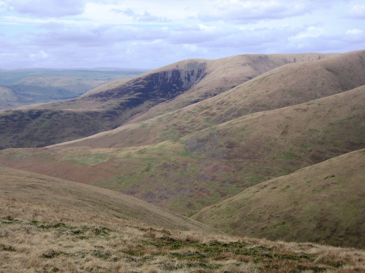
in 2009, but both paled in comparison to the dismal weather that accompanied me in 2004. Much of the sprawling top of Great Shunner Fell is marred by ugly peat hags and extensive areas of wet moss that mean it can never be considered a great hill, though the route of the Pennine Way is clear enough. Slowly I made my way along the increasingly wet path gradually gaining height for mile after long mile, plunging into the clouds and blindly following the sometimes vague path up the hill.

While I remember the low cloud I don’t remember whether it was raining though it wouldn’t surprise me, however I have no doubt that it was windy since it is almost always windy at the top of high hills. At the summit of Great Shunner Fell is a cross shaped shelter providing respite from the wind no matter which direction it may be coming from. When I reached the top I remember making my way to far side of the shelter, in the lee of the wind, only to find a small group of walkers already there. One was bending over and cried out when she saw me prompting me to put my hand up and beat a hasty retreat. I have no idea what I had interrupted and I was in no hurry to find out. From the safety of the other side of the shelter I had my lunch before setting off back down the hill. I think I had considered alternative routes of descent, but they would all have involved taking to the boggy ground with no path to follow in the poor weather and low visibility. The gradients are so gradual on Great Shunner Fell that route finding would have been horrendously difficult without the sure guide of the Pennine Way so I took the only sensible option.

Returning along my route of ascent I headed back down the hill finally emerging out of the clouds and away from the bogs to reach firmer ground that would eventually take me all the way back to Hawes. This was a really simple, and easy, walk following a very popular path up a hill that should have had far-reaching and widespread, albeit distant, views. The summit was a long time in coming, and in the rain and mist never seemed appear. The top was not an appealing place to be so I was not sorry to come back down even though it left me with plenty of time to explore the markets of Hawes. This hill deserves good weather and since it is as a viewpoint that it excels then, on this occasion, I was not able to appreciate it at its best.