After two nights in the Borrowdale Youth Hostel I now travelled across to the Ambleside Youth Hostel for the remaining two nights of my short holiday in the Lake District. I could have lingered in Borrowdale and climbed some of the hills in the area before catching a bus to Ambleside, and various options went through my head, but in the end, partly due to poor weather, I decided to walk all the way to Ambleside by the shortest route. The weather gradually deteriorated during the course of the week and when I left the hostel it was really misty with very low cloud that didn't lift and a constant drizzle all day. I had little incentive to go up any of the fells in the area so I headed straight towards the tiny village of Stonethwaite and into the valley that leads up to Greenup Edge. For most of the day I was following in the tracks of the Coast to Coast walk which passes over Greenup Edge, however that starts this section from the village of Rosthwaite requiring walkers starting from the youth hostel to make a significant diversion to the north to reach the village only to then turn south again and head into the Stonethwaite Valley.
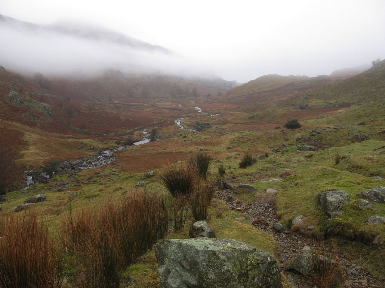
I skipped all that by walking along the road, retracing my steps of two days previously going from the hostel to the village of Stonethwaite and from there across the valley onto the bridlepath that heads over Greenup Edge. At Easter 2010 I was thwarted in my attempts to get very far along this valley by exceptionally heavy rain (and snow melt), but I had no such problems now and was able to sail along the path into the misty weather that awaited me. Since 2010 I have walking down from Greenup Edge many times, most recently in 2016 in improving weather, but this was the first time I successfully walked all the way up the valley from Borrowdale to Greenup Edge. The views were non-existent and the path is not particularly good. I don’t have a great opinion of this path, which is why I was considering alternatives, as it very rough underfoot with many scattered boulders that have to be negotiated on a poorly defined path.

The path coming down from Greenup Edge does show signs of recent path improvement so I had no problems coming down and soon reached the bottom of the valley where the path disappears amongst boggy ground. I could see a path on the other side of the valley so headed across the stream but I found that I couldn’t complete the traverse and I had to wade back over the stream only to cross it a third time to reach the path that I had seen. Looking at aerial shots of the scene and studying the map I believe the crossing of the paths from Far Easedale, Calf Crag and Greenup Edge is now some distance north of where it used to be, and where it is marked on maps. The crossing is now at the point where the Calf Crag path makes a sharp left turn, beside a cairn, and this is where I reached it, however the path from Greenup Edge used to keep to the rough ground until it reaches the stream just after Mere Beck and Birks Gill joins. A direct route across the boggy head of the valley from there leads to Far Easedale Head.
After the roughness of the Stonethwaite Valley had been left behind the walk was curiously satisfying. I was even surprised by the Coffin Route, from Grasmere to Rydal, which I think I have used only once before, almost ten years ago, and it now shows signs of being, shall we say, upgraded. The path is now much smoother, which in most places in the Lake District would be, and is, a travesty, but I think here, on this low-level path, it is allowable and enables those less able to walk up a fell the chance to enjoy a little of what the better able can enjoy of the delights of the Lake District. At the end of the path I passed Rydal Hall and through Rydal Park to finally reach Ambleside at the end of a day that shows that the Lake District can still deliver even in poor weather.
No comments:
Post a Comment