Thursday 28 March 2013

The Black Mountain and the Fforest Fawr

Sunday 24th August 2003

In 2003, after a second visit to the Lake District, I returned to the Brecon Beacons National Park for what became the end of an era. I had been visiting the park twice a year for several years, but this was to be my last regular visit before moving on to bigger, though not necessarily better mountains, starting with those in Snowdonia. I had already decided that I was going to go to Snowdonia a couple of weeks after this walk, but I hadn’t planned anything for the August Bank Holiday weekend. It wasn’t until the Friday evening that I decided I wanted to go walking, but by then it was too late to book anything in the tremendously popular Lake District. A phone call to Brecon Youth Hostel revealed that they had spaces so Saturday morning I drove to Hay-on-Wye, on the edge of the national park, where I bought loads of books. On Sunday the weather was glorious so the walk that I’d originally planned to do at Easter, until poor weather diverted me to the waterfalls of Ystradfellte, was put into action.

Parking near the Gwyn Arms pub, I crossed the main road and passed through the wooded valley of the Afon Haffes before climbing out of the valley into the vast upland area that is known as the Black Mountain. I had only once before been to the Black Mountain and that had been eighteen months previously when I had approached from the north and mainly concentrated on the north-eastern edge of the mountain. I was now in the south-eastern corner of the mountain as I made my way through a fascinating area of outcrops and shake holes. There is a bridlepath through the area, but the weather and the terrain was far too good to stay on it, so I darted about from top to top enjoying every moment as I traversed the complex landscape, passing over the tops of Carreg Goch and Disgwylfa. Eventually the interesting terrain came to an end and I rejoined the bridlepath before crossing the Afon Twrch by a ford, but I am unsure what my next move was. I may have visited the trig point on Carreg Yr Ogof, but even if I did not I must have left the bridlepath behind and climbed bare grass slopes to the north-eastern edges of the Black Mountain at Bannau Sir Gaer.

The rest of the walk was a relaxing stroll along the edge of the escarpment while listening to the Grand Prix on the radio (incidentally Alonso won his first race – the first of many). In glorious sunny weather I walked to the highest point on the Black Mountain at Fan Brycheiniog before turning to the south to walk over Fan Hir and down the gently sloping hillside. Eventually I reached the access road to Ty Hendrey which I was able to follow back onto the road a short distance from the Gwyn Arms where a cool drink was gratefully received after a long walk in hot weather. I didn’t return to the Black Mountain for another six years, but I didn’t feel like I needed to as this great walk was the best that could be done over such a vast mountain where gradients are generally shallow. I have not been back to the Black Mountain since 2009, but I must plan a return before too long.

Monday 25th August 2003

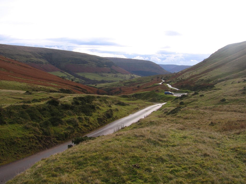
The next day I did a walk around the Fforest Fawr, an area of upland near the Brecon Beacons. The year before I had visited the Fforest Fawr for the first time, but had generally stayed on the western side, so now I wanted to visit the eastern part where are the only significant hills in the whole national park that I hadn’t visited. I parked at a layby near the entrance to the Graig Cerrig Gleisiad National Nature Reserve, but I didn’t start the walk by entering the reserve; instead I crossed over the road onto a track that contains both the Taff Trail and the Beacons Way on the far side of the valley. This took me up to the car parks near the Storey Arms Centre and beyond them, keeping to the Taff Trail, to the Beacons Reservoir. From there a long tedious walk up grassy slopes took me to the top of the vast but featureless hill of Fan Fawr whose only redeeming feature is good views of the Brecon Beacons.

A long walk across the grassy hills took me to the cliff edge of Craig Cerrig-gleisiad. I was now not far from my car but I still had another hill to visit first. A crow would have taken a different route between Fan Fawr and my next target, Fan Dringarth, but the deep valley of Cwm Dringarth and the Ystradfellte Reservoir lay in my way. From Craig Cerrig-gleisiad, I rounded the top of the valley, climbed up to the top of Fan Dringarth and continuing along the summit ridge soon reached the top of Fan Llia. I now really just wanted to return the way I had come, but I am unsure whether I literally reversed my steps or whether I dropped into the western valley of the Afon Llia before heading back towards Craig Cerrig-gleisiad.

Either way I returned to the Graig Cerrig Gleisiad National Nature Reserve where a delightful walk through the unspoilt vegetation of the reserve took me back to my car. This may not have been a great walk over really interesting hills, but it did mean that there was now not anywhere in the national park that I hadn't walked. If I wanted to do new walks now in new areas I would have to stop going there in the future, and that made me sad. I'd come to love the Brecon Beacons; it was almost beginning to feel like a second home as I now knew my way around the area so well! I still look back on my time in the Breacon Beacons National Park with affection as it was where I made where my first efforts in hill-walking and I still occasionally return for visits. By this time however I had already been to the Lake District twice and I would soon make my first visit to Snowdonia. Other mountains beckoned.

Thursday 21 March 2013

Talybont Reservoir and the Waterfalls Walk

Wednesday 23rd April 2003

In the spring following my holiday in the Brecon Beacons, September 2002, that has been described over the last couple of weeks, I was back in Wales for more walking in this fabulous area that had become so familiar place to me. I had been elsewhere over Easter so I didn’t get to Wales until Wednesday, but I must have got up pretty early as I was able to do a long walk over the hills east of the Brecon Beacons around Talybont Reservoir. I parked beside the reservoir near the dam and walked up a bridlepath that took me onto the grass-covered hills north of the reservoir. My diary and my memory are equally unhelpful about this walk with my diary’s only comment being ‘It was a nice walk in good sunny weather.’  I must have followed the dotted black line on the map up Twyn Du to Carn Pica and over Waun Rydd.

At Bwlch y Ddwyallt I’d have joined the route that I’d taken the previous September, but now walking down towards the car park that I’d started from then. Just before reaching the car park I branched off to my right across the road and around the edges of the Talybont Forest. So far in my circuit of Talybont Reservoir I had walked over the hills north of the reservoir and had now I crossed the lowest point in the encircling hills. I am not sure whether I stayed on top of the hills over Pant y Creigiau or entered the wood following the course of an old railway line. I have a feeling that I stayed high with views across the reservoir and passed over Bryniau Gleison before dropping down through the wood to the railway line, but I don’t remember. It could be that the hills south of Talybont Reservoir are dull and utterly forgettable, but I do remember reaching the shore of the reservoir and crossing the dam, where my car lay a short walk further along the road.

This must not have been a great walk as I can hardly remember it, but I do remember what happened after leaving Talybont Reservoir. When I got to the youth Hostel near Brecon I couldn’t find my glasses and immediately had memories of the previous summer when I’d lost my glasses in the Lake District. The last time I had seen them was on top of my car at the end of the walk, but obviously they weren’t there now. In a panic I drove all the way back to the car park only to find my glasses, inside the case, lying on the ground with my map. They were perfectly fine, which was very lucky. I had driven off with them still on top of the car and they’d fallen off. I'd actually done that before with the map (and with hats and other things!), but previously I had always heard the sound of it falling off the top of my car. Now I make doubly sure that I haven’t left anything on top of the car before I drive off.

Thursday 24th April 2003

The next day it was raining and it stayed overcast for most of the day so I decided not to do my planned walk over the Black Mountain as I'd wanted a view and instead I decided to do the Waterfalls Walk. I had done this walk in 2000, but now I wanted to follow the route shown in the pathfinder guide for the area which extends the walk to the Porth yr Orgof cave. The pathfinder guide actually starts the walk from the car park just above the cave, but I started from Pontneddfechan again, beside the Angel pub, possibly because I couldn’t find the correct car park. This was an enjoyable walk despite the poor weather as rain only makes the waterfalls even more dramatic.

After passing the lovely Sgwd Gwladus I followed the River Neath past more waterfalls until I reached Pont melin-fach. At this point I diverged from my earlier walk and continued to follow the river, now on the other bank until I reached Pont Rhyd-y-cnau where I left the river and climbed out of the valley, over the hill and down to the River Mellte at Porth yr Orgoth where I had lunch. I didn’t try entering the cave as that would have been dangerous without supervision, but followed the dry riverbed to the point where the river emerges after its passage through the cave and continued beside the river to Sgŵd Clun-gwyn. At this point I had rejoined my earlier route but this time I wanted to try a different route in order to get a better view of the difficult to see Sgŵd Isaf Clun-gwyn. I did manage to see some of it, but then I had to cross the river lower down. When I eventually started to cross I slipped and saw my right leg plunge into the water right up to my knee as my foot quickly became soaked. I eventually managed to get across by treading carefully in shallow water, but by now the damage was done and I had wet feet for the rest of the walk.

Resuming my walk along the correct path I passed behind the exciting Sgwd yr Eira before climbing out of the valley for the final stroll through woodland back to Pontneddfechan. This is a great walk and I am disappointed that I have never been back. Sgwd yr Eira has skirted controversy over the years with the park authorities worried about the potential danger of walking behind the waterfall. I’m worried about what I may find should I return, but I’m sure it would be worth the effort. Despite only doing two walks on this holiday I managed to hurt my ankle again. I had a similar injury last time I was in the Brecon Beacons, but now I have no idea what I had been doing to cause it, unless it was done when my leg disappeared into the river. These were two very different walks over two completely different terrains, in completely different weather, but both thoroughly enjoyable walks.

Thursday 14 March 2013

The Fforest Fawr and the Brecon Beacons

Wednesday 18th September 2002

Continuing with my holiday from 2002 spent in the Breacon Beacons National Park I am still plagued by a lack of details. I didn’t write up an account of these walks at the time and so much time has passed that I am having difficulty remembering what walk I did on those days. My memory is notoriously faulty so I am reliant on a sketchy comment made in my diary at the time that was more concerned with problems that I was having with my ankle than with any actual description of the walk. The best I can find is a comment to say that I was in agony trying to walk up a hill at the start of the day. Based on this feeble description I have guessed that this was the day that I did my first walk around the Fforest Fawr. Although the national park is called Brecon Beacons the actual Brecon Beacons occupies only a small portion of the whole park. On the extreme west lies the vast area of the Black Mountain, while on the eastern edge lies the Black Mountains (no connection). In the middle of the park is the Brecon Beacons and just to the west of them is the Fforest Fawr.

Fforest Fawr translates as ‘Great Forest’ referring to its historic use as a royal hunting ground that is now an extensive upland area at the centre of Wales’ first Geopark due to its outstanding geological heritage. This designation had not taken place when I walked there over ten years ago and in fact the area is probably the least visited in the whole national park. I parked on the A4067 at the top of Bwlch Bryn-rhudd and immediately began walking up the steep hillside to the south of the road up to the top of Fan Gyhirych. As already mentioned the steepness of this hill aggravated my ankle, but I don’t remember any specific problems with my ankle, though I do remember that this climb was very steep and fortunately it wasn’t very prolonged as I was soon able to enjoy the sunshine at the top.

Setting off along a path that was sometimes muddy, I walked east briefly walking along clear tracks before crossing Bwlch y Duwynt and climbing to the trig point at the top of Fan Nedd. I descended the steep slopes on the other side and briefly joined a road before walking along the Sarn Helen Roman road through a wood and down to a ford across the Nedd Fechan where a large walking group were congregated. Shortly after the ford I left the crowds behind as I took the route of the Beacons Way through a delightful area that is marked on maps more recent to the one I was using at the time as the Ogaf-Ffynon-Ddu Pant Mawr National Nature Reserve. Cutting a corner near the now disused Penwyllt Stone Quarry I joined the track of an old railway that took me back to my car. After my agonies at the start of the walk my ankle eased during the day to let me to finish a good walk in remote upland country.

Thursday 19th September 2002

Despite managing to complete the previous day's walk, I was now seriously considering returning home and I thought I would not be able to do any more walking. However, the next day my ankle seemed better and as the weather was even better than the day before I couldn’t resist going for a walk over the Brecon Beacons. Despite the problems I’d had with my ankle, this walk ended up being the most strenuous of the week, and certainly the best. Unfortunately that is all the description of the walk my diary has given me except for a mention of a dam at the end of the walk, which I had thought was a reference to Talybont Reservoir, but I believe that walk was the following year and wasn’t over the Brecon Beacons. I think this walk is one that I have done several times before and in both directions, but this was the first time.

I parked at a car park on the edge of the Talybont Forest at the top of the pass between Talybont and Pontsticill. I remember my old car struggling to get up the steep road from the reservoir to the car park, but my present car on subsequent visits has had no such problem. I set off north to climb a fabulous ravine formed by the Nant Bwrefwr and around the edge of Craig y Fan Ddu and Graig Fan Las. At the pass of Bwlch y Ddwyalt I turned left and walked along the top of the northern edges of the Brecon Beacons around the top of the valleys that create such a dramatic picture of the beacons. My route took me around the top of Cwm Oergwm to Fan y Big, Cwm Cynwyn to Cribyn and Cwm Sere to the top of the biggest beacon, Pen y Fan. I was now really enjoying the sunny weather and was walking stripped down to my t-shirt while earlier in the week I'd had to wear both my fleece and my jumper.

From Pen y Fan I walked over Corn Du and along the top of Craig Gwaun Taf and Graig Fan Ddu until I reached the trig point on Twyn Mwyalchod. From there I turned east and dropped steeply down to the dam for Lower Neuadd Reservoir. On my last visit to this area the reservoir was full, but on this occasion and on all but the most recent maps this reservoir has been empty. I believe that it was on this dam that my ankle finally gave up and I had hobble along a track through the Taf Fechan Forest onto the road and all the way back to my car. This walk was easily the highlight of a good week's holiday spent walking in the Brecon Beacons. This national park covers a wide variety of terrains, but the highlight is the hills that lend the park its name. In good weather the Brecon Beacons is always a fabulous walk.

Thursday 7 March 2013

Return to the Black Mountains

Monday 16th September 2002

As usually happens at this time of the year, I have run out of recent walks to talk about and there are none more planned until Easter, so I have a whole month of posts to fill with nothing to write about. My practice over the last couple of years has been to talk at this time of the year about the walks that I did a long time ago, but I have come across a problem with that: I can’t remember the walks. Last autumn I wrote about my first ever holiday in the Lake District in 2002, which I had written about in my diary at the time, during the holiday, so I could easily now write about those walks. But for my subsequent walks that year in the Black Mountains and the rest of the Brecon Beacons National Park I wrote next to nothing in my diary. At the time I didn’t feel it was necessary as I was only away for a couple of days, and it actually felt quite liberating not having to talk about what I was doing.

And so now we come to a week’s holiday in the middle of September 2002 that I spent in the Brecon Beacons where the most detail that I wrote about these walks in my diary was that they were good. With a lot of guesswork and a racking of my brains I think I know what walk I did on this date: I did a copy of the first walk I ever did in the Black Mountains, indeed the first walk I ever did up any mountain. I think I didn’t start the walk until about noon as I drove to Wales through the morning, but I still managed to complete the same walk that had taken me all day in 1999 in little more than four hours. I wasn’t taking any pictures back then so this post (and all the posts this month) will have to be illustrated with a picture of the area from a subsequent walk.

Starting from the Gospel Pass, I walked up to the top of Hay Bluff and from there along the Offa’s Dyke Path until I reached the top of the fabulous ridge that had so engaged my enthusiasm three years earlier before descending amid stunning views into the Vale of Ewyas near Capel-y-ffin. The walk was completed by climbing up to the top of Darren Lwyd and then north to the stunning viewpoint of Twmpa where a leisurely descent took me back down to top of the Gospel Pass. I stayed overnight at the now tragically closed Capel-y-ffin Youth Hostel before travelling on to the start of the next walk the following morning. This is a lovely little walk that will always bring special memories to my mind. I was spending a lot of time walking in that area at the time and this walk had in a nutshell everything that kept drawing me back to the area. I’m sure it won’t be too long before I make a return visit, but sadly I won’t be able to stay in the hostel next time.

Tuesday 17th September 2002

The next day I drove south out of the Vale of Ewyas and then north up into the valley of Grwyne Fawr. This was a long drive to move what is actually just a short distance as the crow flies with a single broad ridge separating the two valleys. After parking in the Mynydd Du Forest car park I set off up the valley along the track past Grwyne Fawr Reservoir all the way up to the head of the valley. Turning left I climbed onto the ridge that borders the valley up to Waun Fach, the highest point in the Black Mountains. The previous Easter I had visited this summit for the first time and found a great lump of stone at the top surrounded by a wide area of thick mud. After a warm summer the mud had now dried out, which enabled me to finally reach the huge stone that is generally considered to mark the summit of this flat topped hill.

Continuing along the ridge I passed over the smaller top of Pen y Gadair Fawr and onwards walking between the heather moorland on my right and the eaves of Mynydd Du Forest on my left. Eventually I entered the wood and dropped down the steep sides to the bottom of the Grwyne Fawr valley where I found a footpath that follows the river upstream all the way back to the car park. This was another enjoyable walk in the pleasing Black Mountains, an area that seems made for easy, relaxing walking. Despite having now been to the Lake District I was still quite inexperienced at hillwalking and any bad weather would still have sent me diving for cover, never to come out. Fortunately the weather was good for these walks so I was able to walk along the long grassy ridges in comfort while enjoying the sights and the sounds of the Black Mountains.