My primary goal for this walk was to get to Grasmere from the Hawkeshead Youth Hostel near the shores of Esthwaite Water, but rather than take a direct route I decided to take a big diversion via Carron Crag, the highest point in Grizedale Forest. There are no Wainwrights in the area between Windermere and Coniston Water, but in addition to his seven celebrated Pictorial Guides to the Lakeland Fells, Wainwright also wrote a volume on the Outlying Fells. These are smaller hills on the outskirts of the Lake District more suited to people of advancing years, as Wainwright was by this time. Having done all the primary Wainwrights (all two hundred fourteen fells described in his Pictorial Guides) my attention has strayed onto the secondary Outlying Fells to see if there if is anything there to interest me. I have already visited some of these fells, and indeed the two fells that I walked over the day before this walk, Claife Heights and Latterbarrow, are themselves Outlying Fells typical of the wide selection. Within Grizedale Forest is another Outlying Fell, that of Carron Crag, the highest point in the forest.
Leaving the youth hostel I climbed steep, muddy fields into Grizedale Forest, which covers an immense area between Esthwaite Water and Coniston Water. It is a relatively recent development, having been acquired after the Second World War by the Forestry Commission who promptly planted millions of coniferous trees that now cast a dark shadow over the once open, undulating fellsides. Once the wood was established it was opened up to the public as an adventure park filled with (to quote the Forestry Commission website) “easy going trails for all abilities, MTB routes to test your skills, quiet spots to admire the wildlife and amazing sculptures or places to relax and enjoy some great food.” I had never been to Grizedale Forest before as there was nothing there to appeal to me since, despite the tourist attractions, it is still a timber factory.
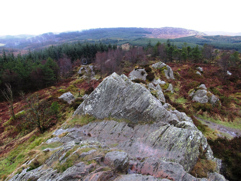
Once on good forest tracks I passed easily over the hill and down into Grizedale valley along one of those wonderful, Lakeland lanes that have provided routes onto the fells for Lakeland farmers for centuries. Passing the deserted Visitor Centre I climbed steeply up the wooded fellside following not only Wainwright’s directions but also red marker posts that reliably showed me the way to Carron Crag. Shortly after turning right at a crossroads I took a narrow path that climbs steeply through the wood all the way up to the summit of Carron Crag, which is free from trees so it enjoys tremendous views across the tops of the trees towards the distant fells. The weather was surprisingly clear at this point with relatively far-reaching views above the low-lying mist that lingered in the valleys.
I have been to Tarn Hows only once before, while on my way to Coniston, and on that occasion I walked around the eastern side of the lake, so now I thought I’d go up the western side, but it didn’t seem long before I branched off the lakeside path to continue my course north. When I joined the byway between Knipe Fold and Oxen Fell High Cross the rain stopped and I had an enjoyable time strolling along the lane through stunning wild scenery with fantastic views towards Holme Fell, while splashing through every puddle in the lane. There is something so liberating about splashing through puddles (when no one else is looking) so long as you aren’t getting your feet wet, and my SealSkinz Trekking Socks were working a treat. After reaching the main road I continued northwards past Colwith Force (to which I had to pay a visit), along a quiet land to Elterwater and beside the raging Great Langdale Beck to Chapel Stile.

No comments:
Post a Comment